Table of Contents
Worldwide handheld GPS systems are far more than a sat-nav that you would use in your car, or Google Maps on your phone.
With accurate GPS positioning, they are one of the best pieces of equipment to take with you in your kit whether camping trekking or sailing.
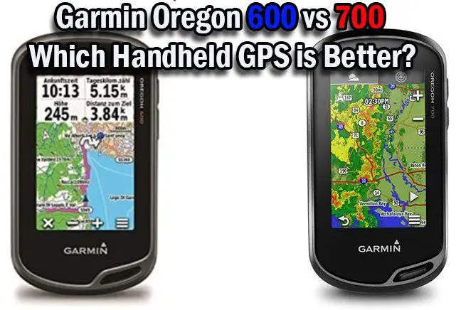
Garmin has a range of handheld GPSs, in particular, the Oregon Series. We are going to compare the Garmin Oregon 600 vs 700.
Once we have looked at their specific features, we will put all of the information in a side by side chart for quick viewing.
After some pros and cons, we will offer our final verdict.
There are quite a few similar features, so we will begin here.
Garmin Oregon 600 vs 700 – Similarities
Quick Glance
Let’s review the details in the following comparison chart.

Appearance
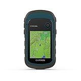
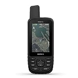
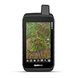
Both the Garmin Oregon 600 and the Garmin Oregon 700 is black with a rugged protective case. They measure 4.5 x 1.3 x 2.4 inches. The Garmin Oregon 600 weighs 7.4 ounces while the Garmin Oregon 700 weighs 8 ounces, but that is splitting hairs.

Navigation
The Garmin Oregon 600 and the Garmin Oregon 700 use dual-band navigation. Along with GPS, they use GLONASS satellites for superior accuracy and speed.
The Screen
The 3-inch multi-touch screens of the Garmin Oregon 600 and the Garmin Oregon 700 are sunlight-readable, so you won’t detect any glare when you are trying to navigate on sunny days.
Sensors
For more than just GPS navigation, the Garmin Oregon 600 and the Garmin Oregon 700 have a 3-axis compass. As well as the accelerometer, you can also read the distance and time to your next location. You can also benefit from a barometric altimeter, so you know your precise altitude too.
Batteries
You can use 2 A batteries with the Garmin Oregon 600 and the Garmin Oregon 700, which is handy because it’s easy to carry spares. They are both compatible with a NiMH pack which will charge when you are connected to an external device. The NiMH pack is sold separately.
Adding Maps
The Garmin Oregon 600 and the Garmin Oregon 700 come with a worldwide base map, but you will likely want to add more. Garmin has additional maps like TOPO U.S 24K and City navigator but they are rather pricey. There is also a good selection of other free and paid-for maps that you can download.
Basecamp Software
To organize your maps and plan routes, the Garmin Oregon 600 and the Garmin Oregon 700 are compatible with the free Basecamp Software. The software also lets you view 2D and 3D topographic maps on desktops and create Garmin Adventures to share with your friends and family.
Warranty
You will receive a 1-year limited warranty with the Garmin Oregon 600 and the Garmin Oregon 700.
There are few differences between the Garmin Oregon 600 and the Garmin Oregon 700 that will influence the buying decision.
Differences Between Garmin Oregon 600 and Garmin Oregon 700
Connectivity
You can connect the two worldwide handheld GPSs via a USB to your external device. They also both have wireless connectivity.
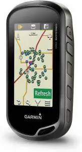
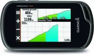
Garmin Oregon 600
You can share your tracks, routes waypoints, geocaches, and your custom maps via ANT or Bluetooth.
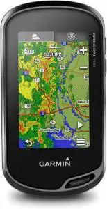
Garmin Oregon 700
As well as ANT and Bluetooth connectivity, the Garmin Oregon 700 has Wi-Fi. This makes geocaching a much superior experience and you can automatically stay up to date with geocaching websites.
The Winner Is- The Garmin Oregon 700
Read next – Garmin Oregon 600 vs 650: Which Handheld GPS is Better?
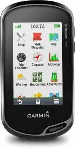
Connect IQ
Connect IQ is a platform that allows you to personalize your handheld GPS. You can download apps, widgets, data fields, and even music streaming services.
Garmin Oregon 600
This model isn’t compatible with Connect IQ.
Garmin Oregon 700
On the other hand, this model is compatible, so you will be able to enjoy more uses for your GPS.
The Winner Is- The Garmin Oregon 700.
Read next – Garmin eTrex 30x vs Garmin Oregon 600T: Which Handheld GPS Navigator is Better?
Durability
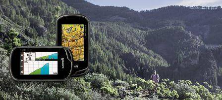
As you will be taking the handheld GPS on many adventures, you want to know that it is up for it.
Garmin Oregon 600
It is impact-resistant so will handle knocks.
Garmin Oregon 700
As well as impact-resistant, it is water-resistant with an IPX7 rating.
The Winner Is- The Garmin Oregon 700
Pros and Cons
Finally, we will include a few pros and cons of the Garmin Oregon 600 and the Garmin Oregon 700.
Garmin Oregon 600
Pros:
- The GPS location is incredibly precise, even under thick coverage
- The touch screen is easy to use and easy to view details
- It has plenty of features and overall a good interface
Cons:
- The software needs improving
Garmin Oregon 700
Pros:
- The navigation is great off-road and on
- It’s easy to use once you have learned the basics
- There are so many options to customize it
Cons:
- It is lacking documentation for the setup
Video Comparison
Garmin Oregon 600
Garmin Oregon 700
The Final Verdict
It is certainly true that if Garmin included better instructions, it would be far easier to enjoy all of the benefits of the Garmin Oregon 600 and the Garmin Oregon 700 and there wouldn’t be such a steep learning curve.
It was difficult to make a decision based on the navigating abilities of these two handheld navigators as they were both brilliant. We found them fast and accurate everywhere we used them. As they were the same size, we also found them both to be comfortable to take around with us.
Today’s winner was the Garmin Oregon 700. The Wi-Fi was definitely an advantage but more than anything, we appreciated that is was water-resistant and this offered us far more peace of mind in bad weather and when you use it for navigating on water.
The Best Selling Handheld GPS on Amazon
- Explore confidently with the reliable handheld GPS
- 2.2" sunlight-readable color display with 240 x 320 display pixels for improved readability
- Preloaded with Topo Active maps with routable roads and trails for cycling and hiking
- Support for GPS and GLONASS satellite systems allows for tracking in more challenging environments than GPS alone
- 8 GB of internal memory for map downloads plus a micro SD card slot.Battery life: up to 25 hours in GPS mode with 2 AA batteries

- Large 3 inch Sunlight-readable color display for easy viewing
- Trigger an interactive SOS to the geos 24/7 search and rescue monitoring center, two-way messaging via the 100% Global Iridium satellite network (satellite subscription required)
- Preloaded Garmin TOPO mapping with direct-to-device Birdseye satellite imagery downloads (no annual subscription), includes multiple global navigation satellite systems (GNSS) support and navigation sensors
- Cellular connectivity lets you access active weather forecasts and geocaching live
- Compatible with the Garmin explore website and app to help you manage waypoints, routes, activities and collections, use tracks and review trip data from the field

- Explore confidently with the reliable handheld GPS
- 2.2� sunlight-readable color display with 240 x 320 display pixels for improved readability
- Preloaded with Topo Active maps with routable roads and trails for cycling and hiking
- Support for GPS and GLONASS satellite systems allows for tracking in more challenging environments than GPS alone
- 8 GB of internal memory for map downloads plus a micro SD card slot

- Large 2.6” sunlight-readable color display for easy viewing
- Expanded global navigation satellite systems (GNSS) and multi-band technology allow you to get optimal accuracy in challenging locations, including steep country, urban canyons and forests with dense trees
- Includes routable TopoActive mapping and federal public land map (U.S. only)
- Compatible with the Garmin Explore website and app (compatible smartphone required) to help you manage tracks, routes and waypoints and review statistics from the field

- Don't have cell coverage or battery dies on your smartphone when you are out hiking, backpacking, or hunting? The Bushnell BackTrack Mini GPS will help you get back to your basecamp or trailhead.
- The Bushnell Backtrack Mini uses GPS technology to capture your trip or waypoint so you can guide back to your starting position. Battery lasts up to 35 hours. Rugged and waterproof to handle anything you put the Bushnell BackTrack Mini GPS through
- Want to store or share your trip or waypoints? The Bushnell BackTrack Mini GPS has Bluetooth to view and sync trips and waypoints to the Bushnell Connect app on your smartphone
- The easy to read display and large glove-friendly buttons make the BackTrack Mini a must-have for hitting the trail. BackTrack Mini gives you elevation gain and decline as well as barometric pressure. It also gives you the day's sunrise and sunset as well as moonrise and moonset
- No expensive batteries required with the BackTrack Mini. Simply charge it with any Micro USB and you're ready to go.

- Explore confidently with the reliable handheld GPS
- 2.2” sunlight-readable color display with 240 x 320 display pixels for improved readability
- Preloaded with Topo Active maps with routable roads and trails for cycling and hiking
- Support for GPS and GLONASS satellite systems allows for tracking in more challenging environments than GPS alone
- 8 GB of internal memory for map downloads plus a micro SD card slot

- The 2.2” high-resolution display is easy to read, even in bright sunlight
- Get long battery life of up to 168 hours in standard mode and up to 1,800 hours in expedition mode with 2 field-replaceable AA batteries (not included)
- Pair with the Garmin Explore app on your compatible smartphone for wireless software updates, trip planning, Active Weather, smart notifications and additional mapping
- Get automatic cache updates from Geocaching Live, including descriptions, logs and hints when paired to the Garmin Explore app on your compatible smartphone
- Multi-GNSS support gives access to multiple global navigation satellite systems (GPS, GLONASS, Galileo, BeiDou and QZSS) to track in more challenging environments than GPS alone
- Premium GPS handheld with BirdsEye Satellite Imagery subscription
- Large, 3” sunlight-readable color display for easy viewing
- Multiple Global Navigation Satellite Systems (GNSS) support to track your travels in more challenging environments than GPS alone plus three-axis compass and barometric altimeter
- Access to BirdsEye Satellite Imagery with direct-to-device downloads and no annual subscription and preloaded TOPO U.S. and Canada maps
- Expanded wireless connectivity supports Active Weather for up-to-date forecasts and animated weather radar and Geocaching Live for mobile syncing and updates

- Large 3” sunlight-readable color display for easy viewing
- Enable two-way messaging and location tracking via the 100% global Iridium satellite network, and trigger an interactive SOS to Garmin Response℠, a 24/7 staffed emergency response coordination center (active subscription required; some jurisdictions regulate or prohibit the use of satellite communications devices)
- Access preloaded TopoActive mapping from Garmin, view satellite imagery, and navigate with multi-band GNSS support and sensors
- When paired with your compatible smartphone, you can access active weather forecasts and Geocaching Live
- Use with the Garmin Explore website or app on your compatible smartphone to help you plan trips and more
- Rugged construction is rated to MIL-STD 810 for thermal, shock, water and vibration
- 5” glove-friendly touchscreen display (50% larger than the previous model) offers easy viewability; available with versatile mounting options
- Multi-GNSS (GPS, GLONASS and Galileo) support — plus preloaded TopoActive maps; outdoor navigation sensors include 3-axis compass and barometric altimeter
- Pro-connected with ANT+ technology, Wi-Fi connectivity and BLUETOOTH wireless networking, giving you direct-to-device access to BirdsEye Satellite Imagery downloads, location sharing, Connect IQ app support and more
- Compatible with the Garmin Explore website and app to help you manage waypoints, routes, activities and collections, use tracks and review trip data from the field
- Rugged, floating, water-resistant (IPX6 — unit level only) handheld GPS with a high-resolution color display and scratch-resistant, fogproof glass
- Increased memory to save and track 10,000 waypoints, 250 routes and 300 fit activities
- Supports multiple satellite constellations (GPS, GLONASS, Beidou, Galileo, QZSS and SBAS) for reliable tracking around the world
- Includes worldwide basemap
- Built-in 3-axis tilt-compensated electronic compass shows heading while standing still
Last update on 2024-04-18 / Affiliate links / Images from Amazon Product Advertising API